


TL;DR
SKiD-SLAM is a distributed, resource-aware LiDAR SLAM system designed for the extreme constraints of planetary exploration, where robots must map unknown terrain without a central server or high-speed internet. By integrating ultra-lightweight descriptors and robust global registration, the system successfully enabled robot teams to collaboratively map lava tubes and cratered fields within a tiny 250 kbps communication budget during real-world field deployments.
What Problem Does This Paper Address?
Most modern multi-robot SLAM (Simultaneous Localization and Mapping) systems are "spoiled" by terrestrial luxuries: high-bandwidth Wi-Fi, GPS, and powerful central servers. Planetary missions offer none of these.
Communication links between rovers on the Moon or Mars are often limited to kilobit-class speeds (similar to 1990s dial-up) and are frequently interrupted. Furthermore, onboard computers must be compact and power-efficient, and the environments themselves—like featureless lava tubes or sparse crater fields—are geometrically challenging. This paper tackles the "systems integration challenge" of building a SLAM pipeline that is distributed (no central server), lightweight enough for low-bandwidth links, and robust enough to handle the unique geometry of planetary analog sites.
Methods
The authors developed SKiD-SLAM, a pipeline where each robot processes its own data and shares only the bare essentials to merge maps. Key components include:
- Place Recognition (SOLiD): Instead of sharing massive point clouds, robots exchange "descriptors"—mathematical fingerprints of a location. They use SOLiD, a handcrafted descriptor that is incredibly compact (only 320 bytes) and rotation-invariant, making it ideal for low-bandwidth links.
- Coarse-to-Fine Registration: To align two robots' maps, the system first uses KISS-Matcher for a "global" coarse alignment (handling large viewpoint differences) and then refines it with Small-GICP for precision.
- Two-Stage Outlier Rejection: Erroneous "loop closures" (thinking two different places are the same) can ruin a map. SKiD-SLAM uses Truncated MSE to check geometric fit at the scan level and Pairwise Consistency Maximization (PCM) to ensure the entire trajectory remains mathematically consistent.
- Distributed Optimization: Robots use a two-stage global-local optimization scheme to merge trajectories without needing a central "brain."
Datasets
The system was validated across three distinct stages:
- Public Benchmarks: The GEODE dataset (specifically the Tunnel sequence) was used to simulate dark, narrow subterranean environments.
- Custom Simulation: The authors built a Gazebo-based Moon simulator using models from NASA JPL’s Open Source Rover (OSR) project to provide ground-truth data for cratered terrain.
- Field Deployments: The core of the report features two real-world analog sites in South Korea:
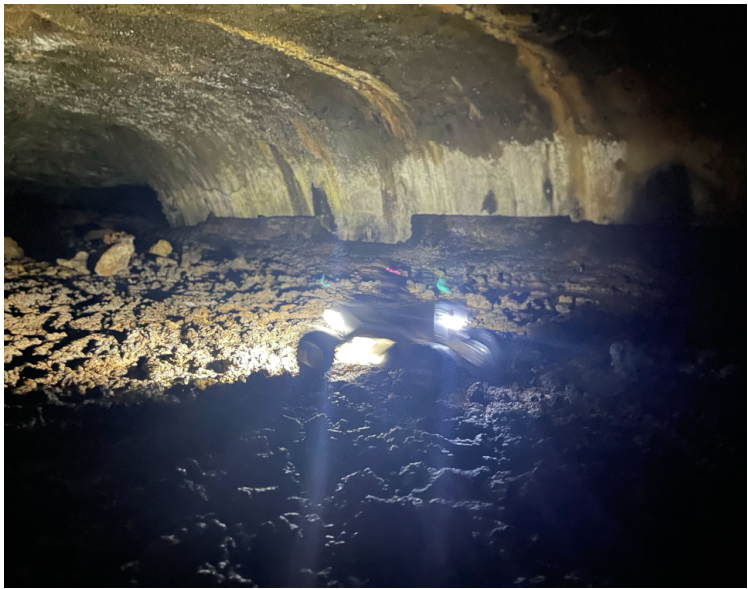
- Majang lava-tube cave (Jeju Island): A dark, rugged environment representing lunar/Martian subsurface habitats.
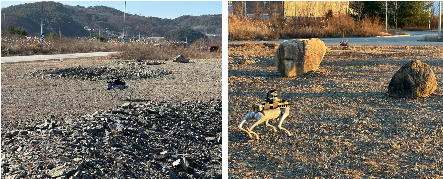
- KICT planetary analog terrain (Yeoncheon): A 40m x 60m site mimicking a cratered lunar surface.
Key Insights and Ideas
- Communication is the Bottleneck: In planetary SLAM, descriptor size is more critical than raw accuracy. The authors found that while some descriptors are slightly more accurate, they require 720x more data than SOLiD, making them unusable on kilobit-class links.
- Global Registration is Mandatory: Unlike indoor robots, planetary rovers often approach the same site from completely opposite directions. Local alignment methods (like standard ICP) fail in these "reverse loops," necessitating global search methods like KISS-Matcher.
- Handcrafted beats Learning-based (for now): In environments where training data is scarce (like the inside of a specific Martian lava tube), handcrafted descriptors like SOLiD often outperform deep-learning models that were trained on urban street data.
Key Results
SKiD-SLAM was the only system tested that could reliably merge maps under a 250 kbps bandwidth limit.
- Efficiency: SOLiD reduced descriptor data exchange by a factor of 30x compared to Scan Context and 720x compared to LiDAR Iris.
- Accuracy: In the Moon simulation, SKiD-SLAM achieved a translation error of just 1.046m for the second robot, significantly outperforming baselines like DiSCo-SLAM (40.9m) which failed to align correctly.
- Field Success: The system successfully merged maps from three wheeled rovers in the Majang cave and two quadruped robots at the KICT site.
Limitations and Future Work
- Heterogeneous Teams: The current field tests used "homogeneous" teams (all rovers or all quadrupeds). Future work needs to address "cross-platform" SLAM, where a ground rover might need to match its map with a flying drone's aerial view.
- The Compute Gap: While the system ran on Intel NUCs (mini PCs), these are still more powerful than the radiation-hardened processors currently used in space. Further optimization is needed for flight-qualified hardware.
- Theoretical Guarantees: The system relies on heuristic thresholds for outlier rejection. The authors aim to develop more principled, adaptive methods for selecting these thresholds based on the environment.
For more details, check out the project page and open-source code: https://sparolab.github.io/research/skid_slam/
Summary updated